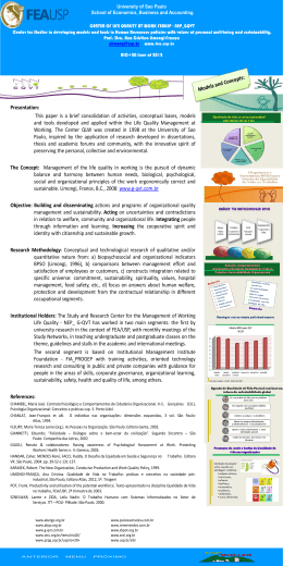
FAPESP RESEARCH PROGRAM on GLOBAL CLIMATE CHANGE ASSESSMENT OF IMPACTS AND VULNERABILITY TO CLIMATE CHANGE IN BRAZIL AND STRATEGIES FOR ADAPTATION OPTIONS Jose Antonio Marengo Earth System Science Center (CCST), National Institute for Space Research (Inpe) FAPESP Process 2008/58161-1 Term: Dec 2010 to Nov 2014 Contact: Rodovia Dutra km, 40, CEP 12830-000, Cachoeira Paulista, SP, Brazil http://www.ccst.inpe.br +55-12-3186-8464 [email protected] Collaborating institutions: National Institute for Space Research (Inpe); São Paulo State University (Unesp-Rio Claro); State University of Campinas (Unicamp); Technological Institute of Aeronautics/Technical Aeroespace Center (ITA/CTA); University of São Paulo (USP-São Carlos). SCIENCE QUESTIONS AND OBJECTIVES Brazil is vulnerable to present-day climate variability and will be profoundly impacted by projected climate changes in the future. Compared to other Latin American countries, Brazil lacks (with few exceptions) of a national and regional strategy for vulnerability assessments and adaptation measures to cope with climate change. Water resources, population, agriculture, health, biodiversity and other key sectors are potentially highly vulnerable to climate variability and change. Social and regional inequalities exacerbate population´s vulnerability to climate change. Therefore, the project aims to establish the base for studies and assessments for impact, adaptation and vulnerability (IAV) in Brazil, using a combination of climate and vulnerability indices based on environmental, geographical-geophysical and social information, in view of identifying areas under risk to climate stress, and to map the vulnerability of population. The project constitutes a step further to the production of future climate scenarios, making use of a new generation of regional climate scenarios which have been generated at Inpe. Specific studies of vulnerability and risk will be done for the Serra do Mar, Paraíba do Sul Valley and São Carlos regions, as well as to the metropolitan regions of São Paulo, Campinas and the Baixada Santista. Project activities during 2011-2014: • The development of future climate change scenarios at regional scales, for various greenhouse gases emission scenarios, together with uncertainty assessments for the XXI Century, using new regional climate models with resolution of 15 km lat long; • The enhancement of understanding of the impacts Figure 1. Research strategy of the project: from the generation of high resolution future climate change scenarios to development of detailed analyses in the State of São Paulo of climate and identification of the main regions potentially to be affected by climate change and the vulnerabilities of their populations in Brazil in the following sectors and systems: water resources, social aspects, weather related natural disasters and mega cities; • The mapping of these vulnerabilities for Brazil using GIS, for the present climate and for some time slices of the present and the future (XXI Century), using vulnerability indices defined based on social, geographical-geophysical and environmental information, as well as indicators of extreme climate events in São Paulo and South America; • The generation of high-quality scientific information to assist public policy in the areas of adaptation and mitigation, as an effective way to ensure that a broader sustainable development perspective is applied for measuring climate change policy and analysis. www.fapesp.br/mcg Intense precipitation events at the IAG-USP Agua Funda station in the city of São Paulo 1933-2010 140 frequency 120 100 >=100 mm/day 80 >=100 mm/day 60 >=50 mm/day >=30 mm/day 40 20 22 50S 23 00S Change in number of houses (%) -100 to -50 -49 to 01 0 +1 to +100 +101 to 300 +301 to +700 23 10S Changes in the frequency of intense rainfall in the Metropolitan region of São Paulo have been observed since 1930, with more days with rainfall above 50 and 100 mm during the recent decades as compared to 1950-60. This is consequence of the urbanization effect (Figure 2). Work has been undertaken to evaluate extreme events and to catalogue known hazard incidences in both areas and partial results show changes in the frequency of heavy rainfall and hazardous events for cities in the Baixada Santista and Campinas: for instance, from 1958-1967 to 1998-2007 Campinas experienced an impressive increase in the number of impacts triggered by precipitation, from 129 to 3,837 (Figure 3). For the municipalities of the Baixada Santista partial evaluations showed that the economic development of the region is based on unsustainable practices: higher number of catastrophic events is associated with higher deforestation rates. Detailed analysis of hazards in the Paraiba´s Valley derived from newspaper information from 1998 until 2008 suggest that the most frequent event (54%) was flooding, followed by severe storms (25%). Landslides accounted for 11 %, almost the same frequency of flooding and landslides (10%). 22 40S CURRENT RESULTS AND PERSPECTIVES 47 10W 47 00W Figure 3. Impacts of intense rain in the city of Campinas, SP during 1958-2007: number of houses flooded for district: 35 districts showed increase while 25 experienced reductions in the number of cases. (Source: Castellano and Nunes 2010) related publications Nobre CA, Young AF, Saldiva P, Marengo JA, Nobre AD, Alves S, da Silva GCM, Lombardo, M 2010. Vulnerabilidade das megacidades brasileiras as mudanças climáticas: região metropolitana de São Paulo. Sumário Executivo. CCST-Inpe, Unicamp, USP, IPT, Unesp. São Paulo, 31 pp. Castellano MS, Nunes LH. 2010. Impactos de chuvas na cidade de Campinas, SP: tendências sócio-espaciais em 50 anos. In: Simp. Bras. de Climatologia Geográfica, 9, Fortaleza, CE, 2010. 16p. Chou SH, Marengo JA, Lyra AA, Sueiro G, Pesquero JF, Alves LM, Kay G, Betts R, Chagas DJ, Gomes JL, Bustamante JF, Tavares P. 2011. Downscaling of South America present climate driven by 4-member HadCM3 runs. Climate Dynamics. DOI 10.1007/ s00382-011-1002-8, in press. Marengo JA, Tomasella J, Alves LM, Soares WR, Rodriguez DA. 2011. The drought of 2010 in the context of historical droughts in the Amazon region. Geophysical Research Letters, in press. 2000-2010 1990-2000 1980-90 1970-80 1960-70 1950-60 1940-50 1930-40 0 Figure 2. Frequency of intense precipitation events detected at the IAG-USP station of the city of São Paulo, during 1930-2010 46 50W co-pi’s and associates Iracema F. A. Cavalcanti, CCST-CPTEC, Inpe Regina Alvalá, CCST-CPTEC, Inpe Gilberto Fisch, IAE, CTA Magda Lombardo, Unesp-Rio Claro Eduardo M. Mendiondo, USP-São Carlos Luci Hidalgo Nunes, Unicamp
Download
