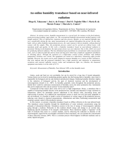
Microsoft Research-FAPESP Virtual Institute for IT Research
World class
research with real
life impact
www.fapesp.br/convenios/microsoft
DEVELOPMENT AND APPLICATION OF NETWORK
OF GEOSENSORS FOR ENVIRONMENTAL MONITORING
Celso von Randow
National Institute for Space Research (INPE)
This project proposes activities of research
and technological development to test the use of
a prototype of environmental sensors (geosensors)
in a study site of tropical forest in Amazonia,
Brazil, forming a sensor network with high spatial
resolution, and to develop software tools for data
quality control and integration. The main premise is
that the geosensors should have relatively low cost,
what enables the formation of monitoring netwoks
with a large number of sensors spatially distributed.
The project is composed of three main
components: 1) assembly and calibration of
prototypes of geosensors of air temperature and
humidity, with reproductive and reliable ceramic
sensor elements that will adequately operate
under the environmental conditions observed in
the tropics; 2) development of software tools for
management, quality control, visualization and
integration of data collected in geosensor networks;
and 3) realization of an experimental campaign, with
the installation of the sensors in the Amazonian
forest, with the objective of estimating the spatial
variability of temperature and humidity complementing
a flux tower in a complex terrain, to better describe
the properties of the air flow and horizontal advection
within and above the canopy near the tower.
Rain forest: image of the experimental area
MAIN RESULTS
Products/publications
Basic installed database/web server and
development workstations with the following
capabilities: a) The database can import and organize
data collected from a network of sensors (since the
sensor data for this project are not still available, it has
been used data from a similar project to start building
the database infrastructure); b) Basic reporting ability,
including the ability to create time-series plots from
each sensor/mote data; c) Basic data access through
web services is under development and test.
Is has already started testing some analysis and
visualization algorithms with the data. Since the sensor
database that has been used contains only time series
of measures of the temperature and humidity sensors,
tools to visualize and highlight discrepancies in time
series have been developed that should behave more
or less the same.
Also under implementation is a generic selection
and sampling tool that will create a subset of the
dabatabe with the sensors´values selected accordingly
to the users´criteria.
The next steps will be the creation of a more
generic tool based on these concepts and its
deployment through the project´s web page.
international conferences
Development of
geo-based sensors
prototype assembling
sensor calibration
energy consumption
wireless transmission
software tools
quality control
metadata base
data integration
visualization tools
Von Randow C, Santos RDC, Rocha HR. Network of
environmental sensors in tropical rain forests. Talk presented
at Microsoft Research Faculty Summit 2010. Redmond, WA. July
12-13, 2010.
Santos RDC. Development and application of network of
geosensors for environmental monitoring. Talk presented
at 2010 Microsoft Research eScience Workshop. Berkeley, CA.
October 11-13, 2010.
Von Randow C, Santos RDC, Rocha HR. Network of
environmental sensors in tropical rain forests. Paper accepted
for presentation at 2010 AGU Fall Meeting. San Francisco, CA.
December 13-17, 2010.
national/local conferences
Von Randow C. Tackling spatial variability in biosphereatmosphere interaction studies. Talk presented at MicrosoftFAPESP Environmental Science Workshop. São Paulo, SP.
November 11-12, 2010.
Rocha HR. The geosensor network experiment in the Atlantic
forest. Talk presented at Microsoft-FAPESP Environmental
Science Workshop. São Paulo, SP. November 11-12, 2010.
field work
prototype testes
in field conditions
temperature and humidity
spacial variability study:
stability conditions and
CO2 age
Project’s main challenges diagram
Celso von Randow
Instituto Nacional de Pesquisas Espaciais (Inpe)
Ministério da Ciência e Tecnologia (MCT)
Rodovia Presidente Dutra, km 40
12630-000 – Cachoeira Paulista, SP – Brazil
[email protected]
55.12.3186-9321 / 3186-9459
Download