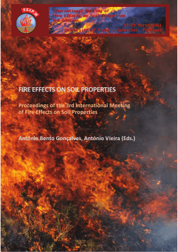
FIRE EFFECTS ON SOIL PROPERTIES
Proceedings of the 3rd International Meeting
of Fire Effects on Soil Properties
António Bento Gonçalves, António Vieira (Eds.)
3rd International Meeting of Fire Effects on Soil Properties
15-19 March 2011 | University of Minho | Guimarães, Portugal
The frequency of fires and land degradation - Cabeço da Vessada do
Monte, Serra da Cabreira
Flora Ferreira Leitea*, António Bento Gonçalvesb, António Vieirab, Luís da Vinhac
a
Centro de Estudos em Geografia e Ordenamento do Território (CEGOT), Núcleo de Investigação em
Geografia e Planeamento (NIGP), Departamento de Geografia (Pd.D. Student), Minho University, Campus
de Azurém, 4800-058 Guimarães (Portugal),
b
Centro de Estudos em Geografia e Ordenamento do Território (CEGOT), Núcleo de Investigação em
Geografia e Planeamento (NIGP), Departamento de Geografia, Minho University, Campus de Azurém,
4800-058 Guimarães (Portugal);
c
Núcleo de Investigação em Geografia e Planeamento (NIGP), Minho University, Campus de Azurém,
4800-058 Guimarães (Portugal)
* [email protected]
Key-words: Cabreira mountain, forest fires, recurrence interval, soil degradation
Introduction
The mapping on the spatial distribution of scorched areas in the municipality of Vieira do
Minho, in the period 1990-2007, unequivocally confirms the high vulnerability of this
territory to forest fires (Bento-Gonçalves, A., 2006, Ferreira-Leite et al., 2010), especially
in the area of the Serra da Cabreira.
The maximum recurrence of fires in this area, recorded over a period of 18 years (19702007) shows that in some situations certain areas were scorched by fire five times, as is
the case of Cabeço da Vessada do Monte, which is located in the northern sector of Serra
da Cabreira, in the Cabeço da Vaca (Ferreira-Leite, F. and Bento-Gonçalves, A., 2008)
(Fig. 1).
Figure 1. Location of the Cabeço da Vessada do Monte study area
198
3rd International Meeting of Fire Effects on Soil Properties
15-19 March 2011 | University of Minho | Guimarães, Portugal
Figure. 3. Burnt areas in 1991, 1995, 1998, 2005 e 2006 - Cabeço da Vessada do Monte
study area.
Similarly to what happened in much of the mountain, the area of Cabeço da Vessada do
Monte was scorched by the great fires of 1975 and 1981. These scorched almost all the
decades old forest (Bento Gonçalves, 2006), which accounted, as already mentioned, for
the replacement of the woodlands by thickets.
Subsequently, many reforestation plans have been approved throughout the years,
corresponding to the reflorestation several dozen hectares. However, most plans did not
make it off the paper. In the cases when they did, most of the times the young stands were
scorched before they could ever develop into true forest areas.
This area has been particularly affected by the more recent forest fires, having been
scorched by fire, between 1990 and 2007. It was scorched a maximum of 5 times (Fig. 2),
in the years 1991, 1995, 1998, 2005 and 2006 (Fig. 3).
In the medium term, there seems to be a tendency for the time required for these same
areas to be scorched again to be lessened, revealing that some portions of this territory are
subject to frequent and sometimes large demonstrations of forest fire risk (Ferreira-Leite,
F. et al., 2010).
Unlike the fires of the 1970s and early 1980s that were of high intensity due to the
presence of adult forest tree populations, the fires more recent fires have occurred
essentially in scrublands meaning that the fires are of medium and low intensity.
In this area, where soil is still present, weeds can reach 50 cm in height in about 2 years
(photo 1), which makes for a high level of combustibility that allows fires to occur every
two years. This is due, in large part, to the high levels of precipitation (Table I).
199
3rd International Meeting of Fire Effects on Soil Properties
15-19 March 2011 | University of Minho | Guimarães, Portugal
TABLE I. Udometeric Post located in the Cabreira Mountain, Municipality of Vieira do Minho (19611990).
Average Annual Precipitation
Udometeric Post
Altitude (m)
(mm)
Guilhofrei
2705,7
350
Salamonde
2281,9
550
3071,1
775
Zebral
Source: INMG, 1961-1990
In effect, the precipitation concentrated in the autumn and winter months could help to
dramatically accelerate the erosion process. However, despite this concentration, it occurs
throughout the whole year, contributing primarily to a very fast recovery rate of
vegetation, allowing for a high productivity of biomass that will be crucial in protecting
the soil against physical erosion (fot. 2).
Photo 1 and 2. Scrublands in serra da Cabreira, municipality of Vieira do Minho.
In fact, the scrublands are the dominant trait in the regional landscape, mainly due to the
fact that it represents about 50% of the total occupied area of the mountain (Smith, 2000,
p. 46).
Inside the scrubland unit there are several types of species, namely the Cytisus striatus,
Genista cinerea, Erica arborea L. There are also areas where other species, such as Ulex
and various types of heathers, are predominant.
These species have pyrophytic characteristics, with flammability and calorific values of
medium to high level (Table II), which can influence fire behaviour and facilitate the
ignition and consequent spread of fires.
Table II. Inflammability and Calorific power - shrub species.
Inflammability
Calorific power
Erica
Genista falcata
Ulex parviflorus
Cytisus multiflorus
low
medium
high
unknown
Source: Adapted from Vallette, 1990; Martin and Lara, 1989 in Silva e Páscoa, 2002.
200
3rd International Meeting of Fire Effects on Soil Properties
15-19 March 2011 | University of Minho | Guimarães, Portugal
Rather than consider the different species in isolation, it is especially important to
characterize the vegetation formed by these species. Therefore, we are also interested in
the combustibility of scrubland (Table III), since this landscape unit is the dominant type
in the study area.
Table III – Combustibility of scrubland.
Underdeveloped
low
Height <30 cm
Intermediate
medium
Height 30-50 cm
Developed
high
Height >50 cm
Source: Adapted from Ronde in Silva and Páscoa, 2002
By destroying or reducing, even if temporarily, the vegetation coverage and taking into
account the dominant presence of steep slopes (Ferreira-Leite, F., 2008) and the high
values of precipitation, the fire contribute significantly to degrading the soil and
accelerating erosion. However, the severity of this degradation is a function of the
frequency and the intensity patterns of the fires.
The low intensity of recent fires5, due to a high recurrence rate, can be verified in the field
immediately after their occurrence. Also, the severity of the effect of the recurrence of the
fires was evaluated using the vegetation as a bioindicator of the soil status (Calvo, 1996),
and it was found that, on average, where there was soil (cambisols - 10-20 cm) it was
dense to less dense and the roots were covered, thus indicating a low degree of physical
erosion, a fact corroborated by the presence of small incisions and marks on the ground.
Concluding Remarks
In the international literature there are many studies on the effects of different intensities
of fires on soil properties (Smith, A. et al. 2010; Jordán, A. et al. 2010; Lawrence, L.,
2010). However, the frequency has been relatively under studied, which calls for
promoting this kind of study.
This study, albeit in a very early stage, plans to launch the discussion on the relationship
between the frequency of fires and physical erosion, showing that in particular situations,
a high frequency does not always correspond to an accelerating loss of soil.
Indeed, in our sample area, which has a recurrence of up to 5 fires, the recovery rate of
vegetation seems to go against the physical loss of soil. This is due to the high volume of
precipitation, which contributes decisively to the high rate of vegetation growth which
avoids that the soil is not unprotected for too long and subject to an accelerated erosion
process.
References
Bento Gonçalves, A. J. (2006) – Geografia dos incêndios em espaços Silvestres de
Montanha – o caso da serra da Cabreira, Tese de Doutoramento, Instituto de
Ciências Sociais da Universidade do Minho, Braga, 438 pp.
Bento Gonçalves, A. J. (2006) – “A “construção” e a “desconstrução” do património
florestal português no séc. XX – breve abordagem ao caso do concelho de Vieira do
5 Fires with an area of less than 10ha, maintenance of some green branches, partially or totally burned
shrubs (Lampin et al., 2003).
201
3rd International Meeting of Fire Effects on Soil Properties
15-19 March 2011 | University of Minho | Guimarães, Portugal
Minho”. GEO-Working Papers, Série de Investigação 2006/8, NIGP – Universidade
do Minho, Guimarães.
Calvo, D. A. (2002) – Ciencias de la tierra y del médio ambiente, 2.º Bachillerato,
McGraw-Hill, Madrid, 333pp.
Ferreira Leite, F. e Bento Gonçalves, A. J. (2008) – “Alterações no ciclo de fogo na serra
da Cabreira”, Actas XI Colóquio Ibérico de Geografia, Universidad de Alcalá de
Henares, Espanha.
Ferreira Leite, F.; Bento Gonçalves, A.J.; Vieira, A. e Martins, C. (2010) – “A recorrência
dos incêndios na serra da Cabreira como manifestação do risco de incêndio
florestal”, Territorium 17, 2010, p. 93-98.
Ferreiro, A., Fontúrbel, T., Fernandéz, C, Merino, A., Veja, J. A. (2010) – “Indicadores
visuales de severidad del fuego y relaciones com câmbios en parâmetros químicos y
microbiológicos después de incêndio”, Jornadas Internacionales, Diaz Raviña, M.,
Benito, E., Carballas, T., Fontúrbel, M. T., Veja, J. A. (eds.) - Investigación y
Gestión para la Protección del Suelo y Restauración de los Ecosistemas Forestales
Afectados por Incendios Forestales, FUEGORED 2010, Santiago de Compostela.
Jordán, A., Zavala, L. M., Mataix-Solera, J. (2010) – “Impact of fire severity on soil
structure and water repellency in the neo-volcanic axis range (Central Mexico)”,
Jornadas Internacionales, Diaz Raviña, M., Benito, E., Carballas, T., Fontúrbel, M.
T., Veja, J. A. (eds.) - Investigación y Gestión para la Protección del Suelo y
Restauración de los Ecosistemas Forestales Afectados por Incendios Forestales,
FUEGORED 2010, Santiago de Compostela.
Lampin-Cabaret C., Jappiot, M., Alibert, N. e Manlay, R. (2003) – “Une échelle
d'intensité pour le phénomène Incendie de forêts”, SIRNAT – JPRN Orléans.
Lourenço, L., Bento Gonçalves, A. (2010) – “Erosión violenta post-incendios forestales
en Portugal”, Jornadas Internacionales, Diaz Raviña, M., Benito, E., Carballas, T.,
Fontúrbel, M. T., Veja, J. A. (eds.) - Investigación y Gestión para la Protección del
Suelo y Restauración de los Ecosistemas Forestales Afectados por Incendios
Forestales, FUEGORED 2010, Santiago de Compostela.
Pyne, S. J. et al. (1996) – Introduction to Wildland Fire, New York. John Wiley & Sons.
Soares, A. (coord.) (2000) – Atlas da fauna e flora da serra da Cabreira, CIASC, p. 219.
202
Baixar